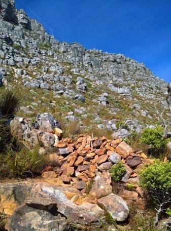
A group of hikers on the beach, Table Mountain. Yes, there is a beach on Table Mountain and many are pleasantly surprised to walk straight on to it, as they break out of the top of Skeleton Gorge on an area called the 'back-table' of Table Mountain, at about 750m above sea level (ASL) ... but obviously, there is no sea.
Instead of sea, the beach is a sandy area on the eastern end of the Hely-Hutchinson dam; one of five dams on the back-table of Table Mountain.
And what makes it a beach has more to do with the geology of Table Mountain, than the water.
Looking across to the wall of the Hely-Hutchinson dam.The rock that is Table Mountain is sandstone, formed on the sea-bed about 500 millions of years ago from sand that was carried by rivers, from the land into the sea. Over those millions of years, that sand was compressed by its sheer weight and compacted to form rock (Sandstone), lying on the sea-bed.
Then, about 350 million years ago, tectonic plate movement under the surface of the earth, caused the sea-bed to lift up, about 3km above the sea, creating the Cape Fold Mountains, which can be seen right across the area around Cape Town.
Two visitors from the US, enjoy the vast expanse of beach, while the dam water level is very low.Over the 350 million years that followed, the rock slowly eroded and broke down into the sand it was once before and naturally moved downwards to lower areas.
So, hikers breaking out from the top of Skeleton Gorge onto the back-table, suddenly find the path becoming very soft and increasingly sandy. Proceeding over about 40 metres of sand dune, hikers are then suddenly and pleasantly surprised, to find themselves standing on the beach.
Ready to visit the beach? Book one of our guided Table Mountain hikes and experience this and many other fascinating features of Table Mountain through the eyes of a knowledgeable local guide.
CAPE TOWN: A truly special place on earth
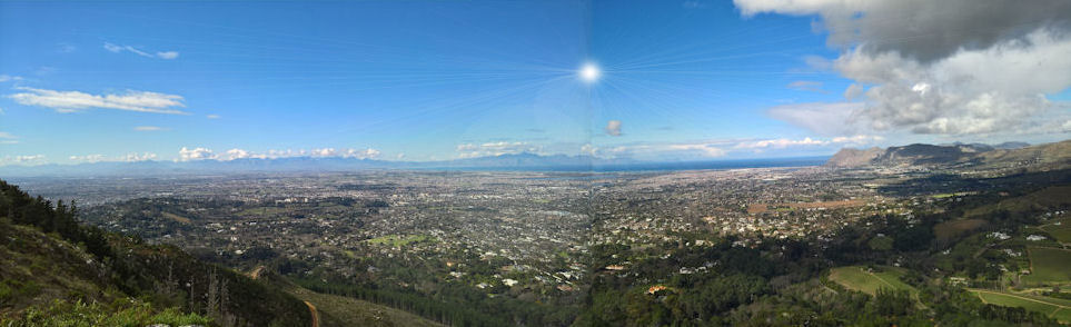
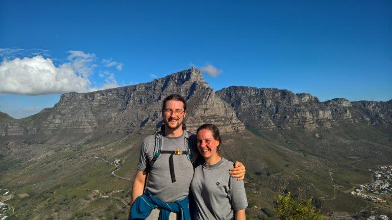
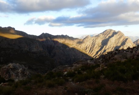
Sunday, 28 June 2026 Hout Bay from Noordhoek Peak : just one of many spectacular views in Cape Town.
Cape Town is one of the world's most distinctive cities, with a remarkable natural history that combines ancient geology and extraordinary biodiversity, to create spectacular natural landscapes.
The Cape Peninsula, is bounded by the Indian and Atlantic oceans and the interior mainland. Cape Town sits at one of the world's great oceanographic transition zones where cold Atlantic and warmer Indian Ocean influences interact. This mixing helps create exceptional marine biodiversity.
The colder Benguela Current of the Atlantic and the warmer Agulhas current of the Indian ocean, give rise to a water temperature difference of 5°C on either side of the peninsula.
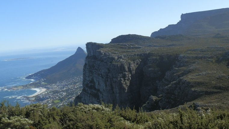
The Cape Fold Belt is a vast mountain system extending for roughly 800 km across the southern Cape.
The sedimentary Sandstone and Malmesbury Shale that forms the Cape Fold Belt is more than 500 million years old; older than the Alps, Himalayas and Andes.
At the time that the Cape Fold Belt - of which Table Mountain is a part - was pushed out of the sea by tectonic uplift associated with plate collision, it is estimated to have been 3km high and has since eroded down to just over 1km above sea level.
During periods of lower sea levels, Robben Island formed part of the mainland and could be reached on foot.
Erosion and weathering of the rock, creates a soil that is uniquely low in nutrient and mineral value.
Despite this nutrient-poor soil, the Cape Floristic Region (the smallest of the world's six floral kingdoms) - is contained in an area of only 90 000 km2 - yet produces the highest biodiversity on the planet.
Disa Orchid : One of many species endemic to the Cape Floristic Region.
The area contains nearly 9000 plant species, 70% of which are endemic (found nowhere else on Earth) and more species per/km2 than the Amazon.
Table Mountain alone contains more plant species than the entire United Kingdom.
The Cape Floristic Region is a UNESCO World Heritage Site.
The unique Fynbos vegetation depends on periodic fire for regeneration. The pods, in which seeds are buried underground, burst open during fire and then germinate at the next rainfall to produce a new generation of the plant.
The kingdom boasts 11 000 marine animal species, 3 500 of which are endemic and 560 vertebrate species including 142 reptile species, of which 27 are endemic.
Lions, elephants, rhinoceros, buffalo, and leopards once roamed the Cape Peninsula before disappearing during European inhabitation.
The Table Mountain Ghost Frog lives only in a handful of mountain streams on the Cape Peninsula.
Penguins at Boulders Beach Cape Town, South Africa - just 45min drive from the city centre.
Southern Right whales migrate to the South Coast from June to November to mate and give birth. The shallow waters of Walker Bay - just 2hrs drive from Cape Town - make Cape Town one of the world's premier whale-watching regions.
One of the world's best-known African Penguin inhabits Boulders beach on the Cape Peninsula.
Archaeological evidence shows that early modern humans occupied the southern Cape coast more than 100 000 years ago.
All of this, within 1-2 hour's drive of the city centre!
Is it safe to hike Table Mountain alone?
Sunday, 21 June 2026 The easiest hikes on Table Mountain have claimed the most lives.
It is never advisable to hike any mountain solo, simply because there is no one with you to help or to get help, if you have an accident.
Table Mountain is very close and accessible, so many visitors are fooled into thinking 'this is easy'; but every year the metro's rescue services are called out and every year the mountain claims a few lives.
It is no coincidence that most accidents have happened on the two most popular hikes in the city - Lions Head and Platteklip Gorge on Table Mountain.
Since 2000, no less than 38 people have died on just these two 'easy' hiking routes. In the last year, the Wilderness Search and Rescue service (WSAR) has been called out 109 times.
The summit of Table Mountain is 1087m above sea-level (1069m at the upper cable station), so whichever route you choose to go, you have to ascend approximately 700m vertical metres.
Hiking up the front face, you're looking at 2-3.5hrs, while from the eastern or western sides, you're looking at 4-6hrs.
Most visitors to Cape Town, think of hiking as following a 'trail' that has been cleared and is maintained for human usage. It's not like that.
Because Table Mountain is so wide and flat on top, the contour path around the base of the mountain makes numerous approaches (routes) accessible; all pioneered by amateur hiking and rock-climbing enthusiasts. Those paths have been created over the years, by continued human usage, but very few of them have ever been sign-posted or maintained.
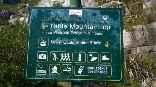
There are five routes on the front face of the mountain, but only two of them are sign-posted and only Platteklip Gorge is graded an 'A' (easiest), yet it is that route that has claimed 17 of the 38 lives.
The other four are 'scrambling' rather than 'hiking' routes, on which you will be exposed to cliff-edges and will have to use your hands to hang on, or climb up short rock faces - yes, your 'hike' has suddenly turned into a climb.
So, how does the easiest route on Table Mountain claim the most lives? ... a failure to understand the terrain and conditions, or your own fitness; and a lack of preparation, resulting in dehydration, heatstroke, fatigue.
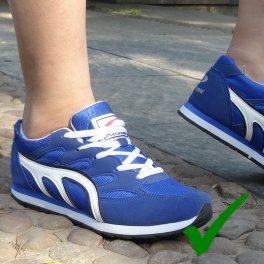
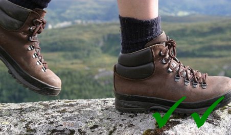
Dehydrated, over-heated and tired hikers are more prone to slipping on rocks, or falling off paths; especially if you don't have appropriate footwear - you shouldn't go hiking Table Mountain in flip-flops or high-heels!
Flip-flops are a definite no!OK! ... a reasonable compromise.Ideal! ... strong boots with ankle support.
And while you started out in warm 23°C temperatures, don't be surprised to be suddenly freezing cold, at the top.
Another thing to consider are the crime-related incidents, of which there have been 71 in the last year; but these mostly happen on the lower slopes, around Signal Hill and Rhodes Memorial.
If you insist on setting out alone, then at the very least make sure that you understand the potential dangers and minimise the risks you might encounter:
Check the weather report
Dress appropriately, with comfortable, light-fitting clothing; and make sure to take something warm for the summit.
Wear strong, rubber-soled shoes or boots.
Take and drink (at least) 2l of water.
Eat breakfast to ensure you're well-nourished and have the energy to complete the hike; and take some fruit or snacks.
Make sure your mobile phone is fully charged and you have the number for WSAR (+27 21 937 0300); bearing in mind that you are only likely to get a signal on the edges of the mountain.
Most importantly, know where you are going and the route that is going to get you there - you must have the expertise and experience to use a map and compass, or a GPS receiver ... if not, BOOK A GUIDE!
What wildlife lives on Table Mountain?
Saturday, 04 July 2026
Table Mountain is famous for its breathtaking views, but many visitors are surprised to discover how much wildlife lives among its cliffs, forests and fynbos-covered slopes. While the mountain is only minutes from Cape Town's city centre, it remains home to a remarkable variety of animals and plants, many of which are found nowhere else on earth.
A Landscape Once Roamed by Giants
When Europeans first settled at the Cape in the 17th century, the surrounding area supported an extraordinary abundance of wildlife. Lions, Leopards, Elephants, Buffalo, Hippopotamus, Eland and Quagga all roamed the Cape Peninsula. Over the centuries, these large mammals disappeared as human settlement expanded, with the last Leopard in the area reportedly seen near Hout Bay in the 1930s.
Although these iconic animals are now gone, Table Mountain continues to support a fascinating variety of wildlife that hikers encounter every year.
The Animals You're Most Likely to See
Rock Hyrax, more commonly called 'Dassie'.
Without question, the animal most visitors encounter on Table Mountain is the Rock Hyrax, more commonly known as the Dassie. These small, furry creatures can often be seen sunning themselves on rocky outcrops or peering curiously at passing hikers. Despite their rodent-like appearance, Dassies are actually among the closest living relatives of elephants - a fact that surprises almost everyone.
Another familiar sight is the Red-winged Starling. These striking birds are commonly seen around viewpoints, cliffs and picnic areas, where they glide effortlessly on the mountain winds.
The exquisite colours of the Orange-Breasted Sunbird.
If you're lucky, you may also spot the Cape Sugarbird or the Orange-Breasted Sunbird. Both species are closely associated with the mountain's fynbos vegetation and are among the most colourful birds in the Cape. The Orange-Breasted Sunbird, with its iridescent orange, blue and turquoise plumage, is found only in southern Africa and is considered one of the jewels of the Cape Floral Kingdom.
Birds of Prey Above the Cliffs
Keep an eye on the skies while hiking and you may witness one of Table Mountain's most impressive predators. The Verreaux's Eagle, more commonly known as the Black Eagle, nests on the mountain and can occasionally be seen soaring high above the cliffs. With a wingspan approaching 2.3 metres, it is one of Africa's most spectacular birds of prey. It hunts the Dassies and patient observers are sometimes rewarded with sightings of these magnificent hunters riding the thermals above the mountain.
Other raptors found on Table Mountain include the Peregrine Falcon and the African Harrier-Hawk.
Wildlife You Might Be Lucky Enough to Encounter
Some of Table Mountain's residents are far more elusive.
The Klipspringer, a small antelope specially adapted to life among rocky cliffs, is occasionally seen on quieter sections of the mountain. Caracal, a medium-sized wild cat that can weigh up to 20 kilograms, also occur on the mountain but are rarely observed because they are primarily nocturnal and naturally avoid people.
A female Chacma Baboon with it's young, in Cecelia Forest.
Chacma Baboons inhabit parts of the Cape Peninsula and may occasionally be encountered on the lower slopes around Constantia and Tokai. These intelligent animals have become accustomed to humans in some areas and should always be observed from a respectful distance. Feeding baboons is both dangerous and illegal.
Another unusual resident is the Himalayan Tahr. These mountain goats are descended from animals that escaped from a zoo near the University of Cape Town many decades ago. Although a major culling programme was undertaken in the early 2000s, occasional sightings are still reported on the mountain.
A Himalyan Tahr, alien to South Africa but survives well on Table Mountain.
Snakes and Other Hidden Residents
Several snake species occur on Table Mountain, including the Cape Cobra, Boomslang and Puff Adder. However, sightings are relatively uncommon on popular hiking routes, and snakes generally prefer to avoid human contact whenever possible.
One of the mountain's rarest inhabitants is the Table Mountain Ghost Frog. This remarkable species occurs nowhere else on Earth and survives only in a handful of pristine mountain streams. Because of its rarity and specialised habitat, very few visitors ever see one.
A Biodiversity Hotspot
Perhaps the most extraordinary thing about Table Mountain is not its animals but its plants.
The mountain forms part of the Cape Floristic Region, the smallest yet one of the most biologically diverse floral kingdoms in the world. More than 2 300 plant species occur on Table Mountain alone, many of them found nowhere else on Earth.
During spring and early summer, the mountain's fynbos comes alive with colour as proteas, ericas and restios flower across the slopes, attracting birds, insects and other wildlife.
This remarkable concentration of biodiversity is one of the reasons why Table Mountain is recognised as a global conservation treasure.
Experience Table Mountain's Wildlife with a Local Guide
Many visitors walk straight past some of Table Mountain's most fascinating wildlife without ever noticing it. An experienced guide can help you spot animals, identify birds, explain the unique fynbos ecosystem and share the stories that bring this extraordinary landscape to life.
Whether you're hiking to the summit, exploring the quieter back trails or enjoying a scenic walk through the mountain's diverse habitats, a guided hike offers a deeper appreciation of one of the world's most remarkable natural environments.
Ready to discover Table Mountain's wildlife for yourself? Book one of our guided Table Mountain hikes and experience the mountain through the eyes of a knowledgeable local guide.
Home Affairs chaos threatens holiday plans
Thursday, 12 March 2020
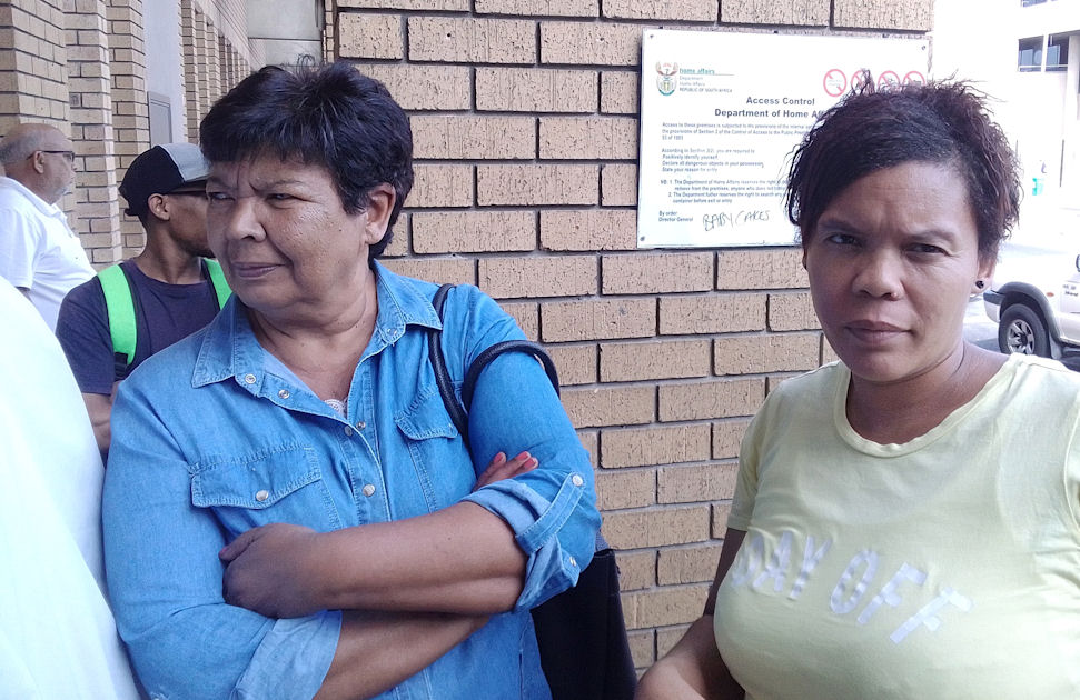
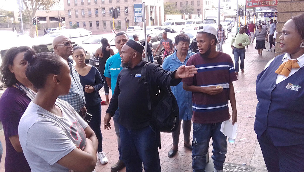
There were scenes of chaos and confusion outside the Bellville Home Affairs offices, as 'system failure' threatened the holiday plans for many disgruntled customers queuing outside in the heat.
According to a source, Home Affairs systems have been 'down' for hours at a time on Tuesday, Wednesday and Thursday this week, causing much inconvenience to complaining citizens. WIth schoold holidays pending many holiday plans could be ruined financial losses caused.
Chief Admin Clerk, Ms Ntomkekhaya Tshandu, confirmed that the 'system had been down' since 1pm and claimed that at 2pm she had told people queuing that the 'systems were down ''. "I have told them they can wait at their own risk" she added.
"I am going to explain to them again now", she added, about other people who had joined the queue, unaware that they were wasting their time expecting to get inside to be served.
She could not confirm any arrangement to give the waiting queue preferential treatment the following day. Customers have to get inside the offices to get a ticket, before queuing again to be served; and as a result many people are forced to come back again and again.
Disgruntled customers, Janeria Venter and Abigail Wessels.
Photo: Tred Magill
Janeria Venter from Belhar and Abigail Wessels from Welgemoed both queued from before 1pm on Thursday, only to be told at about 2pm that the 'systems were down'. "We can't keep coming back like this. Every trip is more bus fare I cannot afford, complained Ms Venter."
"I have been back 5 times" complained Ms Wessels. "And I have wasted about 10hrs or more standing out here in this queue. They also don't give us correct information. I queued for hours and when I got to the front they said I was in the wrong queue; and that they are not processing identity documents on that day."
Provincial Manager, Yusuf Simons tells an audience that 'customer experience is everything'.
Photo: Home Affairs
Western Cape Provincial Manager, Yusuf Simons (yusuf.simons@dha.gov.za) refused to answer his phone or emails and also refused to respond to SMS messages from outside the Bellville offices. He is seen here telling an audience in September 2017 that "customer experience is everything".
It appears technology has gotten the better of Home Affairs, as no manual systems appear to be in place and the department depends entirely on the 'the system'.
Mr Sukeel Sias accuses Home Affairs of lying about its 'system failure', while Ms Ntomkekhaya Tshandu looks on.
Photo: Tred Magill
One angry customer, Mr Sukeel Sias, accused Home Affairs of "lying to the people". "They just say the 'systems are down' but they are letting in people for birth certificates and temporary identity documents. How can the system be down for one application and not another", he argued. Home Affairs official, Mr Michael Hilalentla was overheard confirming this to another customer, but he refused to answer any questions put to him.
Mr Michael Hilalentla and Mr Somelele Sidalit obstruct the doors to make sure nobody gets inside.
Photo: Tred Magill
Mr Somelele Sidalit also refused to provide any information about when the systems would resume, or when customers would be allowed into the offices. Both were uncooperative and viewed this reporter suspiciously, even though this reporter was also a citizen collecting a passport.
Complaining customers gathered at the doors of the offices, which security guards kept obstructed to prevent people pushing through. One man approached the doors at about 3.15pm, saying he had made three visits to the offices to collect a passport. Another disappointed woman walked away muttering: "If the systems have been down since 1pm, I'm sure inside there, they have been doing nothing other than waiting to close the doors at 3.30. At 3.30pm Mr Hilalentla promptly closed the doors.
Standoff defused as activists turn out to save Kataza
Tuesday, 01 September 2020
A tense stand-off between animal activists demanding the return of their beloved 'Kataza' and baboon rangers wanting to recapture the now famous baboon in the Silvermine Nature Reserve, was defused by the intervention of Alderman Felicity Purchase of the City of Cape Town Mayoral Committee, but the fate of the beloved baboon is still unclear.
Alderman Purchase said she had negotiated a truce with Julia Wood of the City of Cape Town and Kommetjie baboon activist Jenni Trethowan "to calm everyone down. Because it was getting tense." Trethowan runs the non-profit Baboon Matters Trust.
"The Baboon Technical Team has agreed that he would not be euthanised, or trapped tonight", said Purchase, "first prize is that he works his way back and settles in Tokai," she said. Trethowan would not confirm the agreement and the @BringBackKataza Facebook page claimed "Kataza is not yet home but we have an agreement that he will be returned to his troop in Kommetjie."
Kataza was recently removed from his home range in the Slangkop mountain above Kommetjie on the Cape Peninsula and relocated in Tokai, where it was hoped he would stay. His removal sparked outrage from locals and a petition for his return which last night counted nearly 8000 signatories.
Activists tracked the baboon through Tokai and into the Silvermine Reserve, through sightings shared on social media. Kommetjie resident, Bradley Thorsen said a small group of about five Kommetjie residents had gathered at the entrance to South African Maritime Headquarters on the Silvermine border, where HWS was seeking access to the mountainside. As word spread through social media, the group grew to about 50, all determined to prevent any harm to Kataza.
According to Alderman Purchase, the activists agreed to leave the area after the City's service provider, Human and Wildlife Solutions (HWS) had located Kataza and then themselves left the area. She said HWS would return in the morning to monitor the baboon.
Alderman Purchase is the Mayoral Committee member for Transport and Councillor for Ward 69, which includes Noordhoek, on the side of the Silvermine Reserve.
How did the media get it so wrong ... or did they?
Thursday, 18 January 2018
The Citizen
The tragic New Years day accident on Table Mountain, that took the lives of Ian Slatem and Chinese tourist Manyee Chu, was initially misreported as an 'abseiling' accident and the deceased woman as a 'Japanese man'. Numerous media organisations described how a 'local guide' and 'Japanese couple' had all 'fallen while abseiling', with two of them 'dangling from ropes', while the third had (miraculously) survived by 'falling onto a small ledge'.
In fact it was a rock-climbing accident and it was only Slatem that fell, with Chinese tourist Manyee Chu killed instantly by a rock apparently dislodged by Slatem, leaving the third woman on the ledge, exactly where she had been before the accident. Photographs of the third woman administering CPR to Manyee Chu were described on social media as part of a rescue that had most likely not even started. And the surviving Chinese tourist was reported to have been 'taken to a local hospital' when in fact she had refused medical treatment and returned to the guest house in which she was staying.
How did the media ALL get it so wrong?
The next morning, News24.com, quoted Wilderness Search and Rescue (WSAR) spokesperson Johann Marais saying: "They were abseiling and were each tied to the rope and all three of them fell the (full) length of the safety rope ... There was no more rope."
News24
That comment prompted me, the writer, to speculate on the cause of the accident on Facebook, which Andre van Schalkwyk, claiming to be the WSAR 'Field Manager' of the rescue, described rather threateningly, as 'complete crap'. He went on to say: "I was the Field Manager on this incident and therefore am fully aware of exactly what occured." If he did indeed know "exactly what occured", why had WSAR reported the incident as an 'abseiling' accident?
I removed the post in anticipation of the correction, promised by Van Schalkwyk ... which never came. So I started to investigate the accident myself, for Weekend Argus. Ironically, it all leads back to Van Schalkwyk himself.
The same day as that News24 report, Africa News Network 7 featured WSAR spokesman, Johann Marais, describing the accident as an 'abseiling accident', to the ANN7 presenter. To his credit, Marais did preface his comments with "Well, we don't exactly know what happened to them", but then went on to say "... all we can tell you is that they were abseiling against Table Mountain and something must have happened which caused the three of them to all fall ... causing injuries to two of them, which was fatal, whereas the third person survived the fall", as if those were all established facts.
When confronted with this, Marais claims the report "must have been edited" and said WSAR is "contemplating filing a complaint with the Press Ombudsperson" because "the media quoted me and put their own information in between, so that it looks like it's all mine, but it's not all mine".
News24, Eye Witness News (EWN), IOL, The Citizen and SABC all consistently 'misreported' those 'facts', quoting Johann Marais of WSAR. Only Times Live appear to have refrained from relying on WSAR, so that report by Dave Chambers was not as jaw-dropping.
IOL and eNCA also quoted SAN Parks regional spokesperson Merle Collins, repeating the same misinformation, which she confirms came directly from WSAR. Collins confirmed that SAN Parks have revised their communication protocols, as a result of the misinformation.
Last week, Marais admitted that the paramedic who attended to Manyee Chu had mistaken her for a man, but he declined to identify the paramedic. Marais also said that at the time of the accident he was 400km out of town and that his information had came from Andre van Schalkwyk (via his "designated messenger"), who led the Mountain Club of South Africa (MCSA) technical team, to retrieve the bodies from the mountain.
The WSAR website still (incorrectly) claims "Three climbers fall on Arrow Final route, one survivor" and points readers to the News24 report.
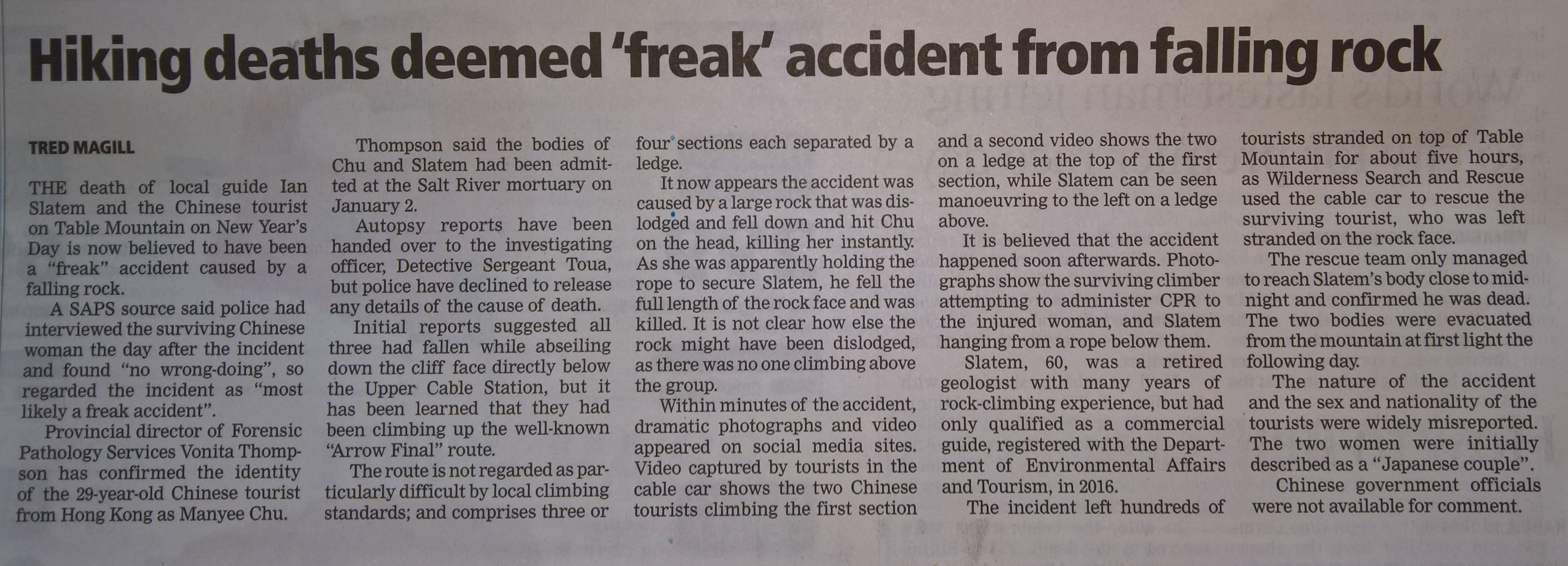
Deaths on Arrow Final were a 'freak' accident
Monday, 15 January 2018
So, the facts as best we're ever likely to know exactly what happened out there on the face of Arrow Final.
Published in Weekend Argus, 13 January 2018
Weekend Argus
It appears WSAR is wholly responsible for the misinformation about this tragic accident, as the media all consistently reported WSAR describing this as an abseiling accident; and apparently the paramedic who attended to Manyee Chu mistook her for a man, thus reporting the tourists as a 'Japanese couple'.
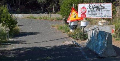
The Dereliction of Tafelberg Road
Thursday, 08 June 2017
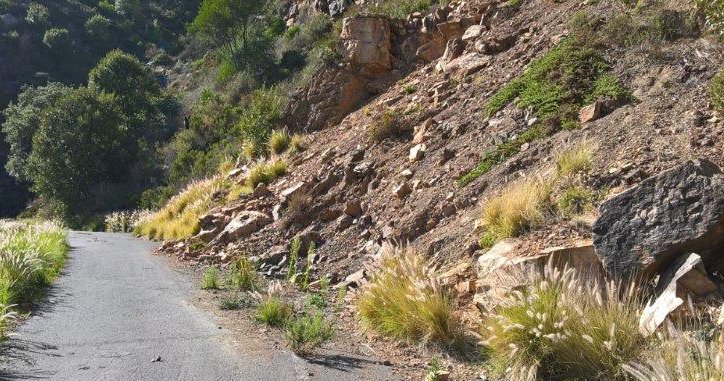
Once offering some of the most stunning views of Cape Town by night, the last 2.7km of Tafelberg Road remains closed to the public and continues to deteriorate.
Tafelberg Road winds around the base of Table Mountain at about 400m above sea level, from Kloof Nek to the western flank of Devils Peak. The road ends just below Woodstock Cave and becomes a footpath leading to Kings Blockhouse and Rhodes Memorial.
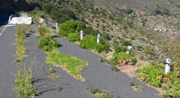
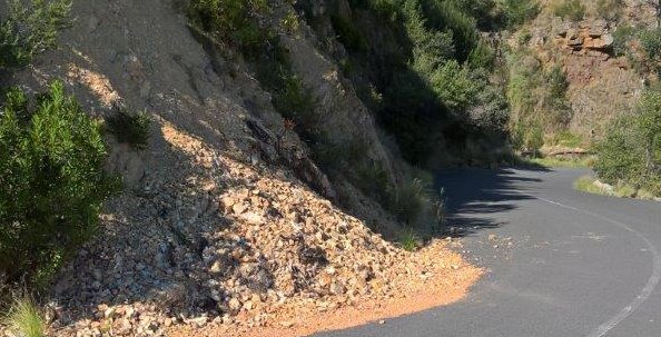
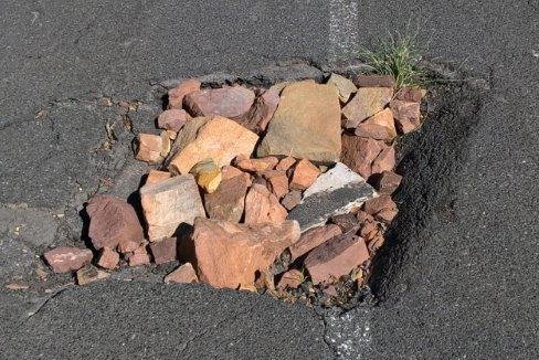
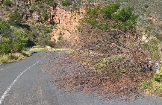
Rockfalls and landslides have damaged the last section of the road, making it impassable for larger vehicles; and a barrier now restricts access. While the City neglects the issue, the road has deteriorated with large potholes and vegetation now growing through the tar.
The road has been closed with a heavy chain and concrete block, on a corner just metres from a culvert that diverts a stream underneath the road.
Photo: Tred Magill
The closure is just metres before a rockslide, which has covered one lane of the road, making the road impassable for vehicles.
Photo: Tred Magill
Further on, part of the road was broken and fallen away, down the side of the mountain; and concrete bollards restrict access, to prevent vehicles driving over the edge.
Photo: Tred Magill
While further on, the vegetation pushes through the tarred road.
Photo: Tred Magill
And landslides that have left soil and rocks covering the road.
Photo: Tred Magill
And loose stones have been used to fill large potholes.
Photo: Tred Magill
And dead, fallen trees obstruct the road.
Photo: Tred Magill
Ironically, if repaired, this end of the road could possibly be used as a holding area for tour coach buses, to alleviate the parking around the lower cable station; and at the same time offer a high-level, scenic view of the city bowl, Lions Head, Signal Hill, Waterfront and Robben Island.
No plans for more parking on Tafelberg Road
Tuesday, 06 June 2017
City Councilor and Mayco member for Transport, Mr Brett Herron.
Photo: www.tct.gov.za/en/leadership/
It seems the City has no intention to provide additional parking on Tafelberg Road, for access to Table Mountain cableway.
Addressing the issue in response to complaints about tour bus operators blocking Tafelberg Road, City Councillor for Transport, Mr Brett Herron said: "parking would be a short-lived solution as research has proven that an increase in road capacity is usually taken up within two to three years." He added that additional bus parking would come at a "substantial financial cost to Cape Town's ratepayers, and possibly the environment."
"The demand for access to Table Mountain will only increase in future and long-term solutions must be sufficiently robust to accommodate this demand. Provision of additional bus parking on Tafelberg Road will come at a substantial financial cost to Cape Town's ratepayers, and possibly the environment."
Instead, the City's Transport and Urban Development Authority, will address Tafelberg Road parking with TMACC, tour bus operators and the public, to find "a cost-effective, environmentally sensitive and sustainable solution".
Without elaborating on how or where, Mr Herron said tour operators should "embrace just-in-time operations and remote holding of their buses".
Meanwhile, tour bus operators can expect stricter enforcement on Tafelberg Road. Cape Town Traffic Services Spokesperson, Richard Coleman said a "Traffic Wardens Project", as is currently in place at the V&A Waterfront and Central City Improvement District, had been proposed as a "short-term recommendation", at a meeting on 24 May 2017. According to Mr Coleman, a total of 66 fines were issued for moving violations, defects and parking in the last four months.
Tourists vandalise Table Mountain Sandstone
Wednesday, 17 May 2017
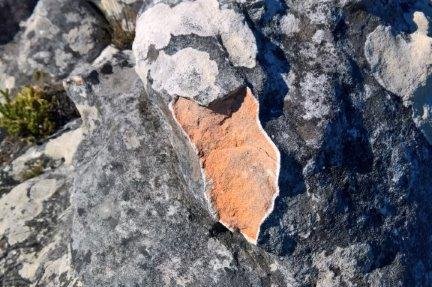
Raw rock exposed and the white Lichen clearly visible above the 'scar'.
Photo: Tred Magill
Tourists are vandalising Table Mountain by breaking off large chunks of Table Mountain Sandstone; apparently to take back home. This can be seen quite regularly on the paths around the Western table, which is controlled by the Table Mountain Aerial Cableway Company (TMACC).
Even though the breaking and removal of any natural resource from Table Mountain is an offence, punishable by a R500 fine; neither TMACC nor South African National Parks (SANParks) have made any effort to stop this practise. Much of Table Mountain Sandstone is covered with Lichen, a kind of fungus which grows on the Sandstone. When the rock is broken, it leaves a very obvious 'scar' on the rock.
A representative for SANParks, Ms Matha Batha and TMACC Managing Director, Mrs Wahida Parker, both said they had not been aware of the problem. SANParks is responsible for the area from Deer Park up to Maclears Beacon, which is the summit of Table Mountain; but the area around the Upper Cable Station is leased to TMACC by SANParks.
TMACC and SANParks have quarterly meetings and a working arrangement to report any issues to SANParks. TMACC also have signage at both cable stations and advise visitors by announcements inside the cable car, not to remove anything.
Tour coaches create havoc on Tafelberg Road
Wednesday, 17 May 2017
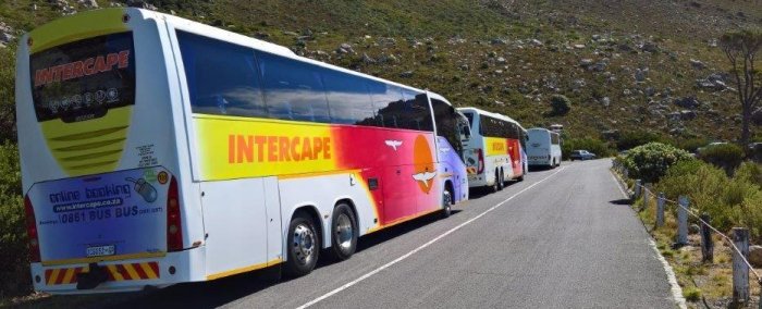
Tour coaches blocking one lane of Tafelberg Road.
Photo: Tred Magill
Tour coaches are blocking Tafelberg road and obstructing traffic, while the Table Mountain Aerial Cableway Company (TMACC) and City of Cape Town, both deny responsibility for regulating Tafelberg road.
The slope of the mountain and the narrow width of Tafelberg Road creates a shortage of parking for visitors. Just beyond the lower Cable Station, there is space for just six to eight coaches.
At the peak of the 2016 season in January, as many as seven coaches were lined up in Tafelberg road, creating a 100m obstruction to traffic. The coaches are wide vehicles and without anywhere to pull off the road, these coaches turn sections of Tafelberg Road into a one-way.
TMACC Managing Director, Wahida Parker, says traffic congestion on Tafelberg Road has been 'repeatedly' raised with the City of Cape Town, but the traffic department 'has not done enough' about the issue.
She added that while a number of initiatives had been taken to alleviate traffic congestion, including the free shuttle serivce running from Kloofnek and the 'Drop & Go' for taxis, the City denies responsibility for Tafelberg Road.
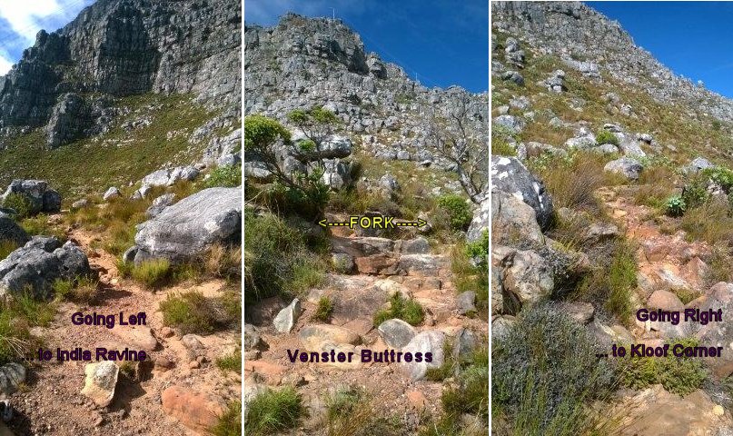
India-Venster fork blocked to dissuade hikers
Friday, 03 March 2017
Blocked: the right-hand fork on India-Venster
Photo: Tred Magill
Since writing on 24 February, 2015, about the confusing fork on the India-Venster path, from which visitors are likely to get lost, I see the fork which leads to Kloof Corner Ridge has been blocked off. I noticed this some months ago and yesterday snapped a photo of the rocks which now block the path.
This obvious indicator is a great help to keep inexperienced hikers away from the more hazardous Kloof Corner Ridge, but sooner or later that pile of rocks is going to disperse.
There is no indication this is the work of SANParks; and if anyone knows whose work this is, I would like to know too; and I still feel a permanent sign, clearly indicating the direction of the India-Venster route is well-advised.
Chockstone Gully: Grade D
Sunday, 11 December 2016
The first pitch of Chockstone Gully
Photo: Chris
11 December, 2016:
Chockstone Gully is an interesting 'D' grade climb on the Eastern Table of Table Mountain, with a variety of stances and moves.
The first pitch is easy enough, as seen in the photo here. On the 2nd pitch a narrow chimney makes the ascent rather awkward, especially if carrying a backpack. And the 3rd pitch features a rather daunting and tricky underhang, which exists through the roof of a chimney.
Overall an interesting climb, requiring a range of technical ability.
Be warned: Skywalk is not a 'route'
Friday, 22 July 2016
As a mountain guide I'm often looking for interesting alternatives to guide tourists up Table Mountain, so it was with great interest that I read of the 'Skywalk' in the 2011 edition of Tony Lourens' book (Table Mountain Classics). So I set out with a girlfriend one day to explore this 'route'.
Kloof Corner is a well known route with a very distinct path. And there is also a very distinct path from there to Venster Buttress, so I wonder why he uses the words 'pick a line' .... which is a term used to refer to an imaginary line which describes the edge or border of a feature of some sort (the base of the rock face, or a narrow gap in the vegetation caused by erosion). Well, we found out a bit further on ...
The India-Venster path is also a distinct and well-used path, but there is no 'line' across to middle Arrow buttress, so we found ourselves 'bundu-bashing' through the fynbos and some very loose ground ... which is of course both difficult and tiring.
Then there is some rocky ground around the base of middle Arrow buttress, which is solid enough ... but coming around that corner into Africa Ravine, leads to ... well just more rocky ground and thick vegetation. So, '... keep an eye out for a line across the slopes ...', is more confusing than helpful.
Ok, so now we're pretty much exhausted and my companion demands to get down via Yellowstone gully; but I advise against this, as I think we're going to struggle more to get down, than to just see this through ... and I don't like giving up. But it doesn't get easier ... just more loose, steep ground and thick vegetation to fight through; and even the traverse into Platteklip Gorge is on a very steep, soft grassy slope ... which is again, awkward and tiring.
In a nutshell, it is grossly misleading to refer to this as a 'route' and to suggest that readers follow 'lines' that do not exist. It took us a full 6 hours to battle across this traverse, which he describes as a '... relatively short, easy day out ...', to be done in 3-4hrs.
Be warned! ... there is no path across this traverse and so certainly not much fun, unless you enjoy fighting your way through Fynbos just to prove you can get from A to B.
Constantia Corner : Grade B
Sunday, 17 July 2016
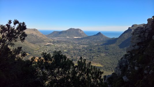
On the southern end of Table Mountain, Constantia Corner must be the most spectacular hike, offering the most stunning views across the Cape Flats to the Hottentot Holland mountains, Cape Hangklip, Constantia Valley, Vlakkenberg and Hout Bay Valley.
The magnificent panorama, taking Constantia Valley and the Cape Flats, right across False Bay to Cape Hangklip.
Photo: Tred Magill
This hike starts at the car park at Constantia Nek. As you pass through the gate and on to the dirt road, a narrow path branches up and off to the left. This takes you up to a small ridge, between Eagles Nest (a large outcrop of rocks on your left) and Constantia Corner above on your right (20min).
The path flattens out and winds up the side, from where you will see right across Hout Bay Valley. A cairn marks a rocky outcrop, where you should turn right and clamber over some rocks for just a few metres before turning right, out of the rocky outrcrop to follow the path up through the thick vegetation. At the top of the ridge you'll find yourself on the Constantia side once again, looking out over the panorama of Constantia Valley, Cape Flats and across False Bay to Cape Hangklip. Navigate around a very large rock (3m high) and follow the path to the next ridge, from where you can see both the Constantia and HoutBay Valleys, on either side.
Looking out across Hout Bay Valley, with Vlakkenberg on the left and Karbonkelberg and Klein-Leeukop in the distance.
Photo: Tred Magill
Now the path meanders about 100m across a small plateau towards a higher outcrop and an obvious, narrow gap. Through the gap and up another 50m and you're on top of Constantia Corner; about 750m above sea level and about 1hr from Constantia Nek. Follow the undulating path through two small valleys and a very interesting rock formation (another 20min) and you'll find yourself looking down on the De Villiers Dam. The path then turns towards the east and meets a concrete road, which is the Bridle Path (or 'Jeep Track').
From here you can opt to follow the Bridle Path to the Woodhead Dam, just 30min further; or turn down to your right and follow the Bridle Path back down to Constantia Nek.
Intrepid couple do the double : Grade B
Thursday, 31 March 2016
Many visitors to Cape Town, want to climb Table Mountain. But it's not often I'm asked to guide tourists up two of our peaks in one day. But Martin and Inge, two intrepid young hikers from Germany were determined to do just that, before the autumn rain set in.
Martin and Inge savour the achievement on top of Lions Head, having completed the two peaks.
We set out late and negotiated our way through the thick traffic on Tafelberg road to find parking. From there, we climbed the steep path to Kloof Corner where they took in the first of the spectacular views on this well-known, yet not so well-travelled route.
Then on to the start of India-Venster and on up, stopping at the 'Venster' (window) for the classic photo opportunity, with the cable car ascending in the background. We stopped on top of Venster buttress briefly, where some iridescent Sunbirds joined us for lunch.
We were doing well and the sky was clearing, just in time to enjoy the views of Camps Bay and Clifton beaches, from Fountain Ledge. At the top, we circumnavigated the circular path around the western table and made our way down in the cable-car.
But Martin and Inge still had energy to spare, and so we pulled into the parking on Signal Hill road, and proceeded up the track around Lions Head. Up the chains and it was only an hour before Martin and Inge were marvelling at the exquisite 360 °C, panoramic views. The double, at a leisurely pace, in just 5 hours of hiking/scrambling. Well done!
Grootkop : Grade A
Sunday, 11 October 2015
The view from Grootkop.
Photo: Tred Magill
Grootkop is one of the peaks of the Apostles', that spans the entire width of the western 'arm' of the Table Mountain horseshoe. The peak features some interesting caves, but which are not that easy to find, as the path is seldom used and difficult to follow. Yet the hike is worthwhile and offers some spectacular views including the entire width of the front face of Table Mountain, Lions Head and Robben Island, which can be seen in the photograph above.
A wider-angled view from Grootkop, taking in the entire Front-table seen in the distance.
Photo: Tred Magill
The peak is easily accessible via the Pipe Track which leads straight into and up Corridor Ravine, to bring you to the top of the Back-table. From there, turn right to follow the Apostles path for about 15min to get to the base of the peak.
As you approach, the Apostles Path continues around the Eastern side of Grootkop and a smaller path veers off on the right to approach the peak directly. The front (northern) face is very rocky and a variety of large boulders and some small, short rock faces have to be negotiated to get to the caves.
The alternative is to follow the Apostles Path to the Southern side, climb up to the summit and then scramble down from the peak, onto the northern face.
Why tourists get lost on Table Mountain
Tuesday, 24 February 2015
Over the years, I've occasionally come across tourists who have lost their way on Table Mountain. Almost all of these hapless tourists have been looking for or thought they were on the very well-known Platteklip route, which many visitors hear about and head for, to avoid the cost of a guide.
Platteklip is indeed a very easy and relatively safe path - certainly the safest for tourists; but then you MUST make sure you are acutally on that path. It recently occurred to me why these folk might be finding themselves on India-Venster, or even Kloof Corner Ridge; without knowing it.
The 'ambiguous' signboard - right behind this sign is the start of the India-Venster route.
Photo: Tred Magill
South African National Parks (SANParks) have this sign on the contour path, directly above the Cable Station and right in front of the start of India-Venster. There is only this sign, which points the way to Platteklip and makes no reference to India-Venster, which starts immediately behind the sign.
So does the hapless tourist follow the direction of the sign, along the contour path, or do they follow the steps behind the sign; and blunder onto the much more precarious India-Venster route, which is far more difficult and on which they might well get lost?
Approaching the top of Venster Buttress - go left and you're looking across towards India Ravine; go right and you're heading towards Kloof Corner.
Photo: Tred Magill
And the 'getting lost' happens at the top of Venster Buttress where the path splits and goes both left (correct) or right towards Kloof Corner Ridge, where I once found two German ladies contemplating the chains up there. Unfortunately, there was nothing there to inform them of the potential danger.
It would help a lot if SANParks were to mark the bottom of India-Venster and put an additional sign at the top of Venster Butress to mark a path that could otherwise become rather perilous.
India-Venster : Grade B
Thursday, 19 February 2015
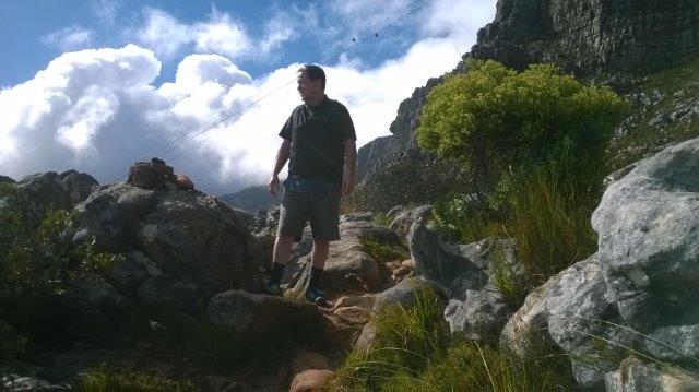
Not at his fittest and a little fearful of heights, it was going to be a challenge, but Paul Sliwa rose to it and achieved the summit of Table Mountain via the India-Venster route, in a very respectable 3 hours.
Paul Sliwa, from Florida, USA, takes in the view from the top of Venster Buttress.
Photo: Tred Magill
The first 30min, from the lower Cable Station to the Contour path, is often enough to put most visitors off. Despite being tempted to quit, Paul doggedly continued up Venster Buttress and finally got his second-wind.
From there it was just the narrow ledges on the upper reaches of Arrow Buttress that nearly unnerved Paul, but with sheer determination and strength Paul hauled himself up and onto Fountain Ledge which we traversed in more leisurely fashion; and on to the top. Well done Paul!
India-Venster : Grade B
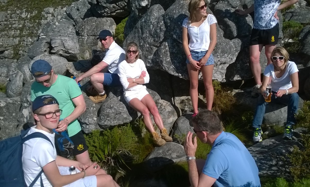
Sunday, 02 August 2015
Group of eight UK visitors enjoying a short break on top of Venster Buttress.
Photo: Tred Magill
A group of 8 visitors from the UK made the most of the extraordinary weather, to cimb the India-Venster route, making for a most spectacular day. With sunny and clear skies, the weather made for exquisite views right across the peninsula and over to see the snow-capped mountains in Du Toits Kloof.
The start and end of all scenery
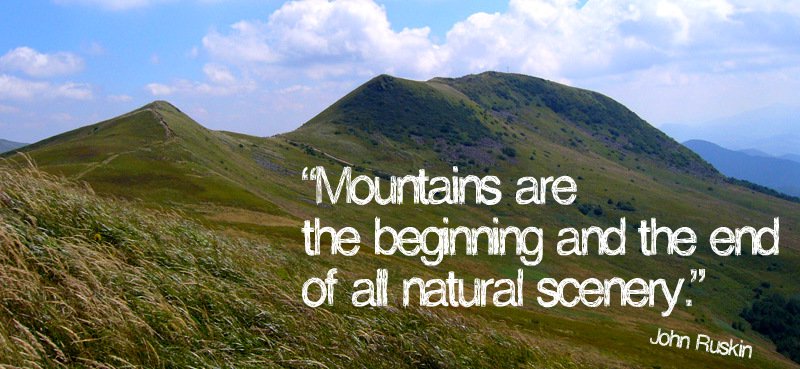
Wednesday, 17 December 2014
Mountains seem to answer an increasing imaginative need in the West. More and more people are discovering a desire for them, and a powerful solace in them. At bottom, mountains, like all wildernesses, challenge our complacent conviction - so easy to lapse into - that the world has been made for humans by humans.
Most of us exist for most of the time in worlds which are humanly arranged, themed and controlled. One forgets that there are environments which do not respond to the flick of a switch or the twist of a dial, and which have their own rhythms and orders of existence. Mountains correct this amnesia.
Photo: Self
By speaking of greater forces than we can possibly invoke, and by confronting us with greater spans of time than we can possibly envisage, mountains refute our excessive trust in the man-made.
They pose profound questions about our durability and the importance of our schemes. They induce, I suppose, a modesty in us. - Robert Macfarlane, Mountains of the Mind: Adventures in Reaching the Summit
Solitude in the Thomas Hut
Sunday, 14 December 2014
It was supposed to be a 3 day hike across the Hex River Traverse, but after a 1000m ascent to the Thomas Hut in the mountains above Worcester, my blistered foot, the harsh sun, my 17kg backpack and a distinct lack of enthusiasm for another 2 days of hiking to the Pells Hut above Ceres, I bid the rest of the group farewell and stayed behind.
Solitude, at last!
The folded mountains above Worcester
Photo: Self
So, what do you get up to when left to your own devices for 2 days, alone in the mountains? First thing to do? Get naked! I stripped off and bathed in the sunshine.
Within 2 hours, I turned bright red and realised my pale skin had had enough of the sun and I should retreat into the hut. There I found and read a small book of short stories from Southern Africa; including stories by Doris Lessing, Alan Paton and Nadine Gordimer. I also found the latest 'Trail' magazine and brushed up my knowledge of trail-running equipment, shoes and nutrition. I played solitaire, but found that decidedly uninteresting.
I heard tiny paws, scurrying around the hut and spotted the mouse that inhabits the Thomas Hut; an interesting creature with amazing agility, managed to climb in a plastic packet hanging from a shelf and out again, up the rough walls of the hut with absolute ease and confidence. An example to anyone with rock-climbing aspirations ... not that I was doing any climbing at all!
Kloof Corner Ridge : Grade C
Sunday, 21 September 2014
Joshua stepping up to the top of the route, with the panarama of the City Bowl in the background.
Kloof Corner Ridge is the distinct ridge that ascends from the Contour Path on the North-Western corner of Table Mountain to Fountain Ledge, just below the Upper Cable Station; and is regarded as the 'classic' D-grade climb on Table Mountain.
The climb starts at Kloof Corner, where a short rock pitch gets you to the next level, from which you begin the ascent up the long slope.
At the top of the slope, you're confronted by a sheer 20m pitch, where a long chain has been installed to assist climbers. A shorter pitch around the right-hand side is a slightly easier alternative.
From there a few more short rock pitches have to be negotiated, before reaching the infamous '11 inch crack', through which you have to sqeeze, before popping out at the top. Then a short stroll over boulders will get you onto Fountain ledge from where you can proceed to the summit ,or descend via India-Venster.
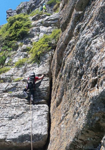
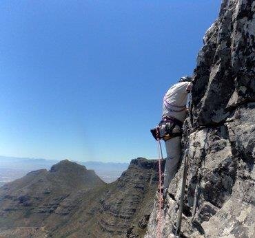
Arrow Final : Grade E
Sunday, 07 December 2014
Preparing to abseil.
Photo: Miles Adams
Climbing up - on the first pitch of Arrow Final.
Photo: Miles Adams
Arrow Final is a series of four pitches on Arrow Buttress, directly below the upper-cable station. It was first climbed in 1897, by the pioneering Travers-Jackson.
We popped up in the Cable car and did 3 long (40m+) abseils to get down to the base of the climb.
The route ascends spectacularly, directly below the cable car, to add a moment of awe and surprise to the visitors ascending in the Cable Car; who often see climbers on the rock-face.
The route is very exposed but is really much easier than it looks, with plenty of hand and foot-holds to help you up.
I'd been wanting to do this rock-climbing route for years - and it was AWESOME!. Thanks to Brian Watts for getting us out and up there.