Once offering some of the most stunning views of Cape Town by night, the last 2.7km of Tafelberg Road remains closed to the public and continues to deteriorate.
Tafelberg Road winds around the base of Table Mountain at about 400m above sea level, from Kloof Nek to the western flank of Devils Peak. The road ends just below Woodstock Cave and becomes a footpath leading to Kings Blockhouse and Rhodes Memorial.
Rockfalls and landslides have damaged the last section of the road, making it impassable for larger vehicles; and a barrier now restricts access. While the City neglects the issue, the road has deteriorated with large potholes and vegetation now growing through the tar.
|
|
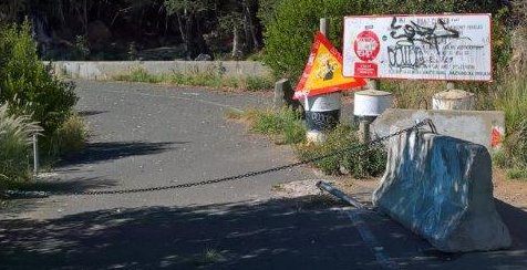
The road has been closed with a heavy chain and concrete block, on a corner just metres from a culvert that diverts a stream underneath the road.
Photo: Tred Magill |
|
|
The closure is just metres before a rockslide, which has covered one lane of the road, making the road impassable for vehicles.
Photo: Tred Magill |
|
|
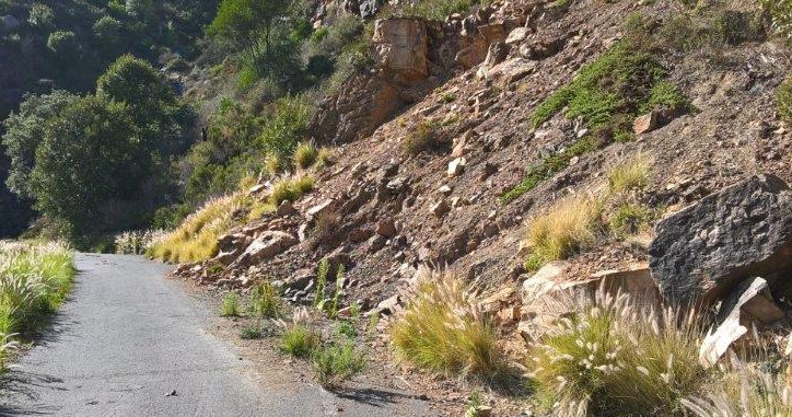
Further on, part of the road was broken and fallen away, down the side of the mountain; and concrete bollards restrict access, to prevent vehicles driving over the edge.
Photo: Tred Magill |
|
|
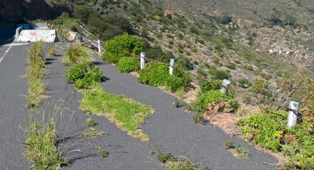
While further on, the vegetation pushes through the tarred road.
Photo: Tred Magill |
|
|
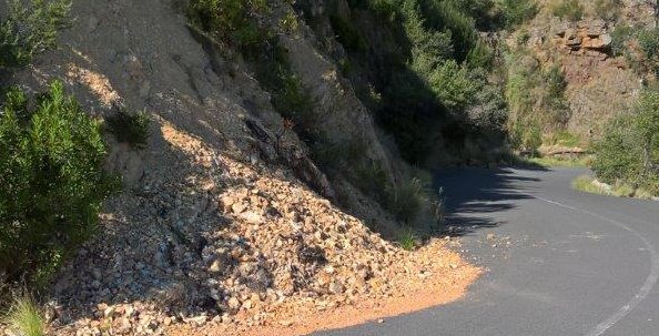
And landslides that have left soil and rocks covering the road.
Photo: Tred Magill |
|
|
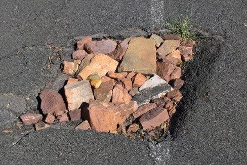
And loose stones have been used to fill large potholes.
Photo: Tred Magill |
|
|
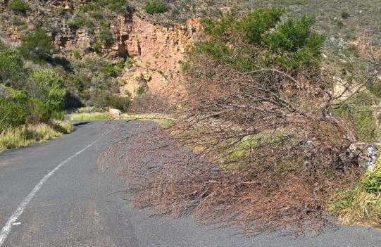
And dead, fallen trees obstruct the road.
Photo: Tred Magill |
Ironically, if repaired, this end of the road could possibly be used as a holding area for tour coach buses, to alleviate the parking around the lower cable station; and at the same time offer a high-level, scenic view of the city bowl, Lions Head, Signal Hill, Waterfront and Robben Island.