Over the years, I've occasionally come across tourists who have lost their way on Table Mountain. Almost all of these hapless tourists have been looking for or thought they were on the very well-known Platteklip route, which many visitors hear about and head for, to avoid the cost of a guide.
Platteklip is indeed a very easy and relatively safe path - certainly the safest for tourists; but then you MUST make sure you are acutally on that path. It recently occurred to me why these folk might be finding themselves on India-Venster, or even Kloof Corner Ridge; without knowing it.
|
|
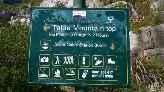
The 'ambiguous' signboard - right behind this sign is the start of the India-Venster route.
Photo: Tred Magill |
South African National Parks (SANParks) have this sign on the contour path, directly above the Cable Station and right in front of the start of India-Venster. There is only this sign, which points the way to Platteklip and makes no reference to India-Venster, which starts immediately behind the sign.
So does the hapless tourist follow the direction of the sign, along the contour path, or do they follow the steps behind the sign; and blunder onto the much more precarious India-Venster route, which is far more difficult and on which they might well get lost?
|
|
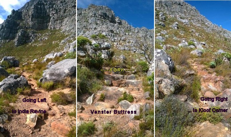
Approaching the top of Venster Buttress - go left and you're looking across towards India Ravine; go right and you're heading towards Kloof Corner.
Photo: Tred Magill |
And the 'getting lost' happens at the top of Venster Buttress where the path splits and goes both left (correct) or right towards Kloof Corner Ridge, where I once found two German ladies contemplating the chains up there. Unfortunately, there was nothing there to inform them of the potential danger.
It would help a lot if SANParks were to mark the bottom of India-Venster and put an additional sign at the top of Venster Butress to mark a path that could otherwise become rather perilous.